Advanced Remote Sensing Study Reveals Water Loss and Sediment Build-up at Mavrokolympos Dam
May 9, 2026 | by admin from
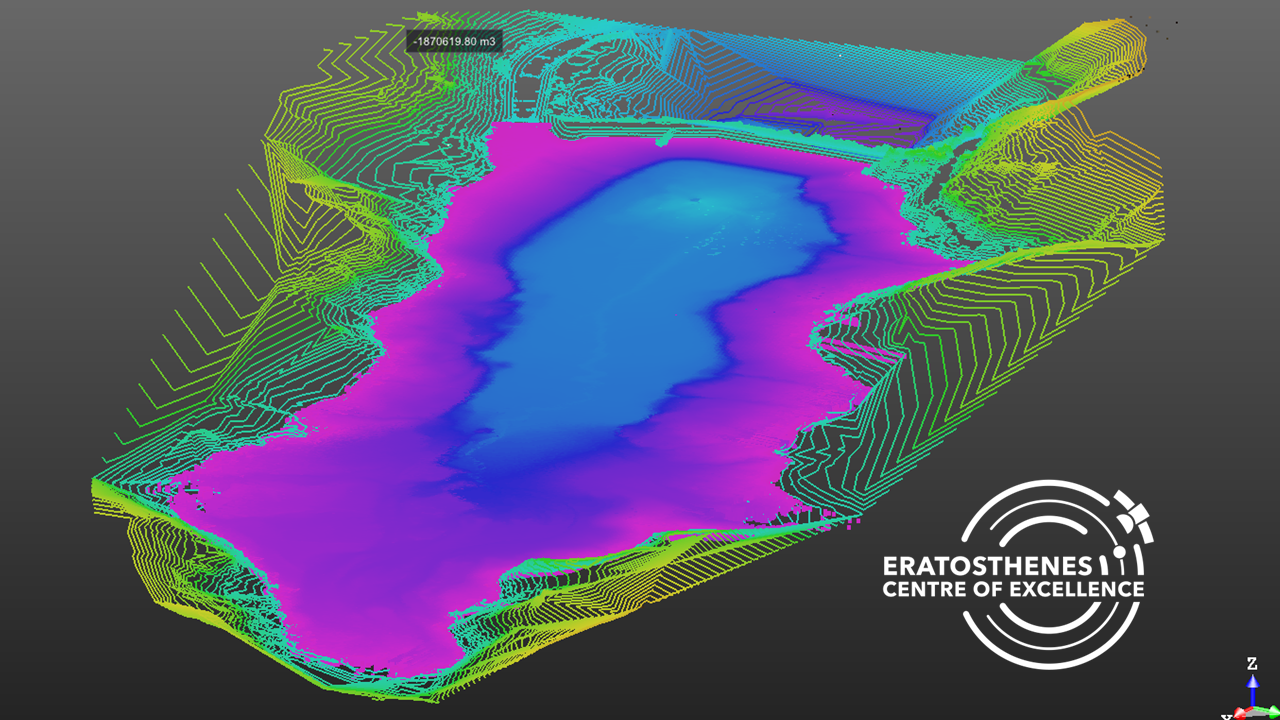
Following the sudden drainage of Mavrokolympos Dam in January 2025 caused by the failure of the dam's discharge system, researchers carried out one of the most comprehensive assessments ever undertaken on a Cypriot reservoir. The study combined multiple Earth Observation technologies—including Terrestrial Laser Scanning (TLS), Unmanned Aerial Vehicle (UAV) photogrammetry, and high-resolution PlanetScope satellite imagery—to accurately quantify water loss, map sediment accumulation, and evaluate the reservoir's remaining storage capacity.
The investigation took advantage of the rare opportunity created by the rapid emptying of the reservoir to compare conditions immediately before and after the incident. Daily satellite imagery captured the dramatic reduction in the reservoir's surface area, while UAV surveys produced ultra-high-resolution orthophotos and digital elevation models of the exposed reservoir bed. These datasets were further validated using millimetre-accuracy Terrestrial Laser Scanning, allowing researchers to generate one of the most detailed three-dimensional representations of the dam ever produced. The integration of satellite, aerial, and ground-based observations provided a level of accuracy that would not have been possible using a single monitoring technique.
The analysis estimated that approximately 1.19 million cubic metres of water were lost during the drainage event. In addition to measuring the immediate impact of the infrastructure failure, researchers quantified decades of sediment accumulation within the reservoir. Their findings indicate that sediment deposition has reduced the dam's original storage capacity by approximately 15% since its construction, highlighting the long-term effects of sedimentation on Cyprus' ageing water infrastructure. Detailed mapping also revealed how sediments had accumulated near the river inflow while finer materials had gradually migrated towards the dam wall, providing valuable insights into reservoir dynamics and future maintenance requirements.
Beyond assessing a single infrastructure failure, the study demonstrated the growing value of integrated Earth Observation technologies for water resource management in semi-arid regions. The combination of satellite monitoring, UAV mapping, and terrestrial laser scanning enables rapid damage assessment, accurate volume estimation, and continuous monitoring of reservoirs, supporting evidence-based decision-making for drought management, infrastructure resilience, climate adaptation, and long-term water security. The methodology provides a scalable framework that can be applied to reservoirs across Cyprus and other water-stressed regions facing similar challenges from ageing infrastructure and increasing climate variability.