Monitoring the Devastating Limassol Wildfire in Cyprus
July 28, 2025 | by admin from
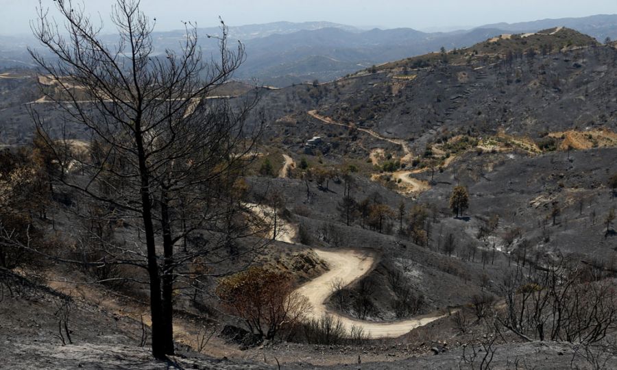
A major wildfire that swept through the Limassol district of Cyprus in July 2025 caused extensive environmental damage, with satellite observations revealing that more than 120 square kilometres of land were affected. According to satellite-based analysis conducted following the event, the burned area represented approximately 1.3% of Cyprus’ total land area, making it one of the most significant wildfire events recorded on the island in recent years.
The wildfire, which began on 23 July 2025, spread rapidly through mountainous and rural areas of the Limassol region, affecting forests, shrublands, grasslands, protected ecosystems, and nearby communities. Earth Observation technologies provided a rapid and objective assessment of the disaster, allowing researchers to map the extent of burned areas, evaluate ecological impacts, and identify the types of land cover most severely affected. The analysis was based on high-resolution satellite imagery from the PlanetScope satellite constellation, captured shortly after the fire, enabling detailed damage assessment across the affected landscape.
Satellite-based land cover analysis demonstrated the wide ecological footprint of the wildfire. Grasslands accounted for the largest proportion of the burned area, representing approximately 51% of the affected land, followed by shrublands at around 31%, forest areas at 15.5%, and residential zones at approximately 1.1%. These findings highlight the vulnerability of Mediterranean ecosystems, where dry vegetation, prolonged periods of heat, and strong winds can create highly favourable conditions for rapid fire expansion.
The wildfire also affected environmentally sensitive areas, including locations within the Natura 2000 protected network, such as the Paramaliou River, Cha-Potami, and Limmati Valley areas. Damage to these ecosystems raises concerns regarding biodiversity loss, habitat fragmentation, soil degradation, and long-term impacts on native flora and fauna. Recovery of Mediterranean landscapes after severe wildfires can require many years or even decades, depending on rainfall patterns, ecosystem resilience, and restoration efforts.
The event demonstrated the critical role of satellite Earth Observation in modern wildfire management. By combining high-resolution imagery, land cover datasets, and geospatial analysis, scientists can rapidly estimate burned areas, identify affected ecosystems, support emergency response operations, and provide reliable information for post-fire recovery planning. Satellite monitoring also complements traditional firefighting approaches by improving situational awareness during active fires and enabling long-term environmental assessments after flames are extinguished.
As climate change increases temperatures, extends dry seasons, and contributes to more extreme fire conditions across the Mediterranean region, advanced Earth Observation systems are becoming essential tools for wildfire preparedness and resilience. Continuous monitoring through satellites, artificial intelligence, and geospatial technologies can help authorities develop early warning systems, improve risk assessments, and implement more effective strategies for protecting communities and natural environments.