EarthView Cyprus: A New Space-Based Platform Transforming Satellite Data into Real-World Solutions
June 11, 2026 | by admin from
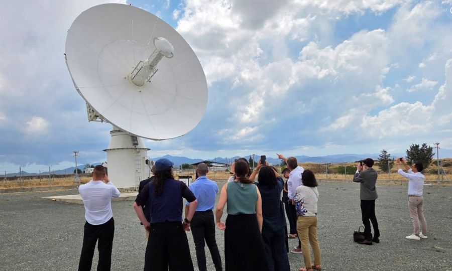
Cyprus has entered a new era in space technology with the launch of EarthView Cyprus, a strategic initiative designed to transform satellite observations into practical solutions for environmental monitoring, climate resilience, economic development, and public safety. The project brings together the ERATOSTHENES Centre of Excellence and Cyta in a partnership focused on strengthening Cyprus’ Earth Observation capabilities and establishing the island as a regional centre for satellite-based services. At the heart of EarthView Cyprus is the Satellite Data Acquisition Station (sDAS), an advanced infrastructure capable of receiving and processing satellite data in near real time from the Cyta satellite station in Pera Orinis.
The initiative represents a shift in how satellite technology can be used—not only for scientific research but as an operational tool supporting everyday decision-making. EarthView Cyprus will enable applications in wildfire monitoring, drought assessment, agricultural management, maritime surveillance, climate analysis, disaster response, and environmental protection. By combining satellite imagery with artificial intelligence, geospatial analytics, and advanced modelling techniques, the platform will help authorities and organisations better understand changes occurring across Cyprus and the wider region.
One of the most important applications of the system is improving Cyprus’ ability to respond to climate-related challenges. The island faces increasing pressures from rising temperatures, prolonged drought periods, water scarcity, extreme weather events, and ecosystem degradation. Continuous satellite monitoring can provide early indicators of environmental stress, allowing authorities to move from reactive crisis management towards proactive planning and prevention. For example, satellite-derived information can support early wildfire detection, identify areas affected by vegetation stress, monitor reservoir conditions, and improve water resource management.
Agriculture is another sector expected to benefit significantly from EarthView Cyprus. Satellite data can support precision agriculture by monitoring crop health, soil moisture, irrigation efficiency, and land conditions. Farmers and agricultural organisations can use these insights to optimise water use, reduce costs, increase productivity, and adapt farming practices to changing climate conditions. This is particularly important for Cyprus, where limited water availability and increasing heat stress create challenges for sustainable agricultural production.
The platform also strengthens Cyprus’ capabilities in maritime and coastal monitoring. Due to its geographic position in the Eastern Mediterranean, Cyprus can use Earth Observation data to support monitoring of marine environments, coastal changes, pollution risks, and offshore activities. The availability of timely satellite information enhances the country's ability to protect marine resources, support environmental regulation, and improve regional cooperation.
Beyond national applications, EarthView Cyprus has a broader strategic importance. Located at the crossroads of Europe, the Middle East, and North Africa, Cyprus is ideally positioned to provide Earth Observation services to a wider geographical region. The initiative supports the country’s ambition to become a regional hub for space technologies by connecting scientific expertise, satellite infrastructure, innovation ecosystems, and international partnerships.